|
|
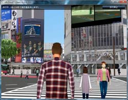
The 11th 3DVR Simulation Contest on Cloud Special Page |
|

|
General information of the contest |
3DVR simulation contest using UC-win/Road. The works are represented with the script (5min) and scenarios and evaluation
and voting are performed with cloud system.
| Voting period Fri. Sep. 7 - Mon. Sep. 17 |
General Voting
You can browze, operate and vote the VR data. Although voting several times
is possible, the content of the work you voted cannot be changed.
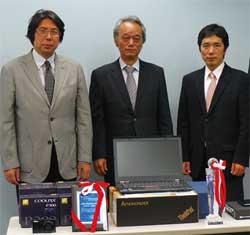
2012.9.19 Wed Final selection Site: Tokyo head office Nakameguro GT tower seminar room MAP
Meeting for selecting nomination works
The judges will decide each award on Wednesday, November 19. The judgment
will be performed by 70% of public voting, 30% of voting from judging committee
based on the ranking point and ranking point for special awards.
Judging Committe
Mr. Hiroo Kasagi - NPO Chiikizukuri Kobo
Mr. Fumio Seki - College of Engineering, Nihon University
Mr. Tatsuoki Inagaki, Pave & Road How-To Way Technology Association
|
 |
2012.9.20 Thu Award ceremony Site: Shinagawa
KOKUYO Hall MAP
|
Results Announcement (Announced September 20, 2012) |
|
|
Project for sharing system of compact EV vehicle using VR simulation
TOYOTA Motor Corporation. |
|
|
| This is an agenda which is being worked on as an initiative in the transportation
(traffic) part of the low-carbon dioxide society system demonstration project
in Toyota city. The vehicles and parking / battery charging station are
placed in a virtual town modeled with high degree of realism based on the
field survey, which is being used for verifying and confirming the basic
service plan such as the fusion of EV and its station with the original
town, procedure of vehicle reservation and its return and the design of
traffic line etc. |
 |
 |

*This movie has sounds |
|
 |
|
The image of a single-driver type Electronic Vehicle (EV), its depot, and
the city of Toyota itself can be confirmed as you run the script. When
you play a scenario, the whole process of renting an EV from reservation
to using the EV can be confirmed. The "Include driving" scenario
allows you to drive from one depot to the next. |
|
|
|
|
|
Simulation for a landscaping plan using point cloud data
Kyushu-orient Servey&Design Co., Ltd. |
|
|
| This VR data has been created based on the point cloud data collected by
the company's own technology as part of the renovation project on Teramachi
street and its surroundings in Nagasaki. The proposal consists of narrowing
of road lanes to force traffic to slow down, widening of sidewalk, laying
down stone pavement on top of the sidewalk, road barriers, |
 |
|
|
|
|
The switch from the current situation and plan is represented using point
cloud in the VR data in which the space is represented via point cloud
measuring data. The switch of before and after of the plan can be confirmed
and lighting-up in Tera Machi can be seen. When manually operating, the
switch of point cloud and lighting-up can be selected according to the
context. |
|
|
|
|
|
Training system for tunnel administrator via VR
BMIA(France) |
|
|
| Within G'Val, FORUM8's UC-win/Road simulates traffic and pedestrians in
a realistic interactive 3D environment. It generates traffic according
to pre-set volumes, speed, signaling and environmental conditions (time
of day, geographic position, climate, light etc...). The project objective
was to develop a VR based training system that would accurately reflect
the real work of Highway & Tunnel Operators. |
 |
|
*This movie has sounds |
|
|
|
This is a VR data for maintenance training using a tunnel monitoring system.
After activating the script, you can see the image of inside of the tunnel
and control screen. It is possible to move the viewpoint to various direction
in order to confirm inside of the tunnel by selecting the landscape position.
Car accident and fire accident are set in this data as an example of the
situation for training.
|
|
|
|
|
|
Restoring the Oomuta street car in 1952 and the town along its railroad
Keisuke Ijiri |
|
|
| This VR could represent the Oomuta street car, which was very popular as
an important transportation for citizens, from the free viewpoint and in
a colored display in which the street in Oomuta where used to be the coal
mining town can be seen. |
 |
|
*This movie has sounds |
|
|
|
Oomuta street car loved by the resident of Oomuta until the street car stopped running in 1952 has been reproduced in the VR environment. Enjoy the scenery and atmosphere of the Showa era in which seeing street car and coal train travel back and forth is quite common. |
|
|
|
|
|
Simulation for urban planning in front of Hokuriku Shinkansen "Iiyama
station"
Iiyama city Construction channel department City planning section/Section for maintening the surrounding of the station of Shinkansen bullet train |
|
|
| This VR data simulates the future Iiyama city in which you can see the
public facility like the station square around Iiyama Station of Hokuriku
Shinkansen planned to be renovated following the opening of the station
itself, which is scheduled at the end of 2014, and the fusion of rich nature
and functions of an urban city apparent in the improved park of Iiyama
castle, a symbol of the city about to celebrate the 450th anniversary of
the castle’s foundation. This VR can be seen in a workshop and forum and
it fulfills an important role for urban planning to work with city hall
and residents. |
 |
|
*This movie has sounds |
|
|
|
Try running the script "View all". <br>Beautifully renovated
area around the Iiyama station, which is a new station for the Hokuriku
Shinkansen, the scenery of Japanese festival taking place in front of the
station, cherry blossoms of Iiyamajoshi park, and beautiful mountains of
Nagano prefecture that can be seen from the park can be viewed as one set
of data. |
|
|
|
|
 |
Honorable Judge's Award Regional Construction Award
Mr. Hiroo Kasagi (NPO Chiiki Zukuri Kobo)
|
|
Aiming for "Alleviating traffic jams in the original route especially
near railroad crossings and narrow bridges".
Nishitetsu C.E. Consultant Co., Ltd |
|
|
| The purpose of creating this VR data visualizing a new bypass route in
the countryside is to obtain in the consensus from the local residents
on the proposed project of building an alternative route through the river,
railroad, and low altitude rice fields in this area to mitigate traffic
congestion that is becoming a problem in the original route especially
near railroad crossings and narrow bridges. Bird's eye view was also created. |
 |
|
*This movie has sounds |
|
|
|
Bypass road, river, railroad are all visualized. By running a script, overpass and underpass as well as how shadows are created can be confirmed from various view including aerial view and train driver's perspective. |
|
|
|
|
|
Honorable Judge's Award Development Award
Mr. Tatsuoki Inagaki (Pave & Road How-To Way Technology Association)
|
|
Experience simulator for ITS spot service
JEITA (Japan Electronics and Information Technology Industries Association)
Car Electronics Commitee / Car Electronics Promoting Comitee |
|
|
| This is an interactive simulator in which an "ITS Spot" installed on a road and "Car navigation system compliant to ITS Spot" built in the car transmits high capacity data with high speed and then wide network of road traffic information, images are visualized on the screen to allow the driver to experience various services that "ITS Spot" service, the next generation of ITS service, has to offer. |
 |
|
*This movie has sounds |
|
|
|
You can experience the service of ITS spot while driving a car. Confirm
the information of ITS spot displayed in car navigation and please drive
carefully. After driving, drivers skills evaluation report will be displayed.
|
|
|
|
|
|
Honorable Judge's Award Accountability Award
Mr. Fumio Seki Nihon University |
|
Simplified assessment for landslide extraction in the south of Nakatusna
Material Hakuba Co., Ltd. |
|
|
| As part of the earth and sand extraction project small enough to be inapplicable to an Environmental Impact Assessment, this VR data was used to explain to local residents how the landscape will change using VR simulation for the benefit of obtaining consensus either at community meeting or on the Web. |
 |
|
*This movie has sounds |
|
|
|
By runing a script, the view of a stone pit from various places around its perimeter and the image of future vegetation can be seen. You can also confirm how the scenery can be changed by alterning around the time or season by selecting the context. |
|
|
|
|
|
Improving the intersection which has a lot of accident and analysing the
effect using DSLog
Korea Transportation Safety Authority |
|
|
| Yangyang street No.3 in Kangwon Province, South Korea is a high accident area according to the slope way. There is not many traffic, but neck phenomena of vehicles frequently occur because of its geometric structure. Moreover there is the peculiar-shaped No.5 in Nonsan city of Chungcheongnam-do and there are a lot of accidents happened. To improve these intersection problem, the present situation and improved situation of the merging traffic, road marking, traffic lights and position of stop line etc. have been implemented, and that was used for decision-making and meeting to explain to local residents. The driving test via simulator was conducted and the improved result was confirmed by analyzing the DS log value. |
 |
|
*This movie has sounds |
|
|
|
This data includes traffic simulation on 2 intersections in Korea; one
in Yang Yang and another in Non San, each designed to compare the image
of before and after the improvement that can be confirmed by running the
corresponding script. It is possible to drive to the intersection by selecting
a road among the choice of road 1, 2, 1(2), and 2(2) after you click on
"Travel". |
|
|
|
|
|
Simulation for pipe plant facility
Kusakabe Electric & Machinery Co., Ltd. |
|
|
| The company sells plant equipments mainly to their clients oversea. Because plant equipments come in all sizes, when they are combined to form one big plant, it may look entirely different from what is shown on the company brochure depending on what combination of equipments are used. UC-win/Road was the perfect answer. By creating a VR data of the finished plant, they were not only able to get a much better picture of its size but also confirm the operation of the machineries within the plant, thus helping them confirm the size and other details of deliverables before they are built. |
 |
|
*This movie has sounds |
|
|
|
By running scripts, each visualizing a particular course of action, you
can confirm the movement of each type of machine or pipe. View can be switched
from plan view to 3D view at vice versa at user's discretion. |
|
|
|
|
|
Simulation for landslide disaster in Suzawa district of Shinshiro city,
Aichi prefecture
Fukui National College of Technology |
|
|
| Suzawa district of Shinshiro city, Aichi prefecture is lash and has a limpid stream, but mudslide had occurred in the past times and the disaster prevention system needs to be constructed. In this VR, the detailed terrain and building are represented for the explanation of the danger of mudslide and the situation of landslide disaster several times because of the heavy rain and the stage of the occurrence are visualized in an easy way to understand. |
 |
|
*This movie has sounds |
|
|
|
A village in a valley is visualized in VR space. Debris-avalanche triggered
by a landslide due to torrential rain is expressed by running a script,
enabling you to confirm how the disaster is initiated from various angles. |
|
|
|
|
 Grand Prix Grand Prix
Semi-Grand Prix (Excellence Award)
Special Awards [ Idea Award / Essence Award / Development Award /Judgment
Award / other awards ]
Nominate Award
Academy Encouragement Award
No dual recipients.
Grand Prix
Certificate / Trophy / High Spec Computer /
Book Card
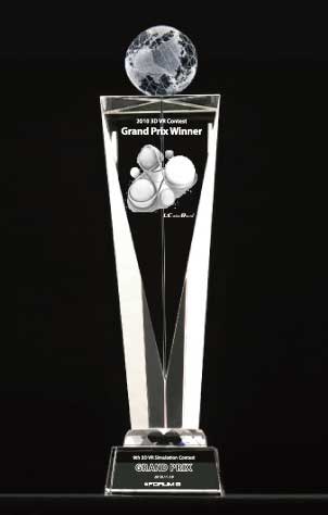 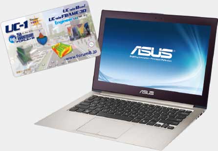
High-Spec Ultrabook Book Card 25,000yen |
Semi-Grand Prix
Certificate / Tablet PC / Book Card
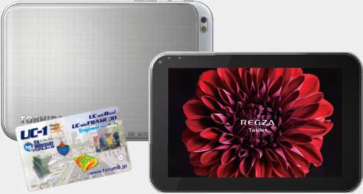
Android Tablet equipped with an organic EL
Book Card 10,000yen |
Special Award
Certificate / Tablet PC / Book Card
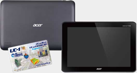
10.1 inch Android Tablet, Book Card 2,500yen |
Nomination Award
Certificate plaque / Book Card
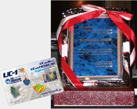
Semi crystal certificate plaque / Free lodging in Tokyo / Book card 2,500yen |

|
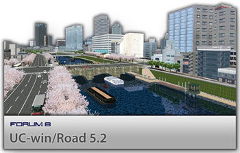
| 3D real-time VR software package which supports the consensus formation
for construction work and public construction. |
 |
|
|
 
|
Users are able to remotely operate inside the UC-win/Road environment that
is run by the server and received by the client on a lighter version of
the software.
As well as being an online video streaming service, UC-win/Road for SaaS
is an interactive real-time VR system.
|
 |
|
|
| |
Introduction of the awarded works of the past contest |

The Grand Prix work of the 10th 3D VR Simulation contest can be checked
via SaaS !
■The past awarded works of the past contest
|
|
 |
"System for checking the position where equipments are installed"
(Japan Railway Construction, Transport and Technology Agency) 
|
|
|
|